Ficheiro:Amsterdam train map.png

Ficheiro original (2 116 × 2 142 píxeis, tamanho: 388 kB, tipo MIME: image/png)
Descrição do ficheiro
| Descrição |
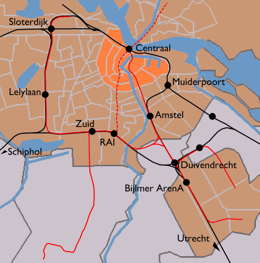
English: Map of Amsterdam's train stations. Greyish orange background denotes the municipality of Amsterdam, bright orange is the Amsterdam-Centrum district. Black lines are railways and red lines are metro lines. Dashed red line is a metro line under construction (to be opened 2013). Black dots are the train stations.
|
| Data | |
| Origem | Image modified by me, taken from Wikipedia Commons (Image:Outline map Amsterdam metro 2.PNG), which uses data from (and copyrighted by) the Dutch Centraal Bureau voor de Statistiek, which "allows anyone to use it for any purpose, provided that the copyright holder is properly attributed. Redistribution, derivative work, commercial use, and all other use is permitted." The map on Wikipedia was made by user Michiel1972, who placed his contribution in the public domain. I am doing the same for my modifications. |
| Autor | CBS, Michiel1972, me ((WT-shared) Mtcv) |
| Permissão (Reutilizar este ficheiro) |
attribution required; PD This image is (in part or entirely) based on geographical data from Statistics Netherlands (Centraal Bureau voor de Statistiek). Digital geometry files in ESRI format can be downloaded from their website [1]. In particular, boundary data of statistical districts is based on either the Wijk- en buurtkaart 2005, or the Wijk- en buurtkaart 2003 ("CBS/TOPgrenzen"). Data on localities (bevolkingskernen) are from the publication Bevolkingskernen in Nederland 2001. Conditions of use (in Dutch):
|
Licenciamento
| Esta obra foi dedicada ao domínio público pelo autor, User: (WT-shared) Mtcv em wts wikivoyage, com aplicação em todo o mundo. Nalguns países isto pode não ser legalmente possível; se assim for: User: (WT-shared) Mtcv em wts wikivoyage concede a todos o direito de usar esta obra para qualquer fim, sem quaisquer condições, a menos que tais condições sejam impostas por lei.
|
Registo de carregamento original
| This file was imported from Wikivoyage WTS. |
- 2007-12-03 14:03 (WT-shared) Mtcv[link morto] 2116×2142 (397547 bytes) {{Information |description=Map of Amsterdam's train stations. |source=Image modified by me, taken from Wikipedia Commons ([http://commons.wi (Import from wikitravel.org/shared)
Histórico do ficheiro
Clique uma data e hora para ver o ficheiro tal como ele se encontrava nessa altura.
| Data e hora | Miniatura | Dimensões | Utilizador | Comentário | |
|---|---|---|---|---|---|
| atual | 20h08min de 17 de novembro de 2012 | | 2 116 × 2 142 (388 kB) | MGA73bot2 | {{BotMoveToCommons|wts.oldwikivoyage|year={{subst:CURRENTYEAR}}|month={{subst:CURRENTMONTHNAME}}|day={{subst:CURRENTDAY}}}} == {{int:filedesc}} == {{Information |description=Map of Amsterdam's train stations. Greyish orange background denotes the munic... |
Utilização local do ficheiro
A seguinte página usa este ficheiro:
Utilização global do ficheiro
As seguintes wikis usam este ficheiro: